
Web-Based Map Presentation Using iT Sensing Application
In a Geographic Information System (GIS), once all spatial data processing has been completed, the next step is to organize the processed data into a format that is informative and ready for publication. This stage is known as map layouting, which is the process of arranging and combining various cartographic components into a single map sheet so that spatial information can be presented clearly, systematically, informatively, and in a way that is easy for users to understand. Map layouting is not only intended to improve the visual appearance of a map, but also to ensure that all information is logically organized and follows cartographic principles.
Why is Map Layouting Important?
Map layouting plays a crucial role in presenting geospatial information effectively. A well-designed map layout is easier to read, understand, and interpret. In addition to displaying the main mapped features, a proper layout includes essential cartographic elements such as the map title, legend, north arrow, scale, inset map, coordinate grid, data source, author information, and other supporting components. Each element should be arranged proportionally so that it enhances the map without obscuring the main content. Therefore, map layouting is an essential final step before a map is printed, published, or used as a medium for communicating spatial information.
Layouting in iT Sensing
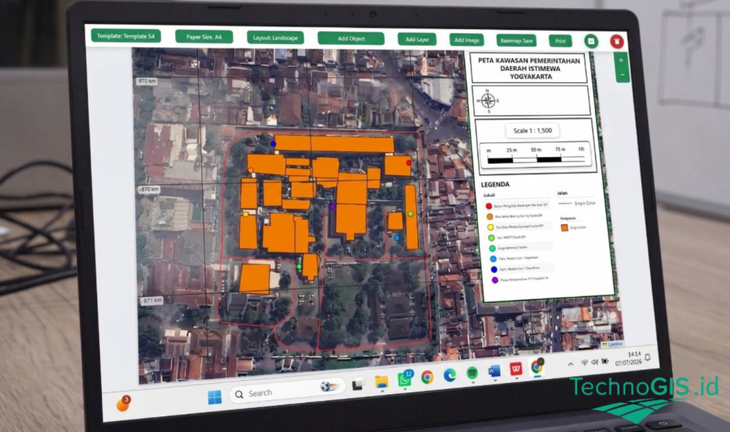
iT Sensing provides a Layout Editor that can be accessed through Publish → Print. This feature allows users to easily design the final map layout using a variety of available tools. Users can select a layout template, define the paper size and orientation, adjust the map scale, add layers, and include various cartographic elements as needed. In addition, users can insert text, institutional logos, supporting images, basemaps, and coordinate grids to produce a more informative and professional-looking map. By utilizing these features, the resulting map not only complies with cartographic standards but is also ready for printing or exporting in the available output formats.
Map Layouting Workflow in iT Sensing
1. Select a Layout Template
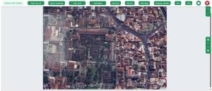
The Layout Editor provides several built-in templates that can be used immediately. Users can choose a template that best suits their needs. Alternatively, a custom layout can be created by selecting New Template, allowing all map components to be arranged according to specific presentation requirements.
2. Set the Paper Size and Orientation
Select the desired paper size from the Paper Size menu, such as A4, A3, Letter, or Legal. Then, open the Layout tab to choose the page orientation. Select Portrait for vertically oriented maps or Landscape for areas with a predominantly horizontal extent.
3. Configure the Map Scale
Using the Scale menu, users can choose Auto to allow the system to determine the most appropriate scale automatically based on the displayed map extent. If a specific scale is required, select Fixed and manually enter the desired scale value.
4. Display the Required Layers
Before arranging the layout, ensure that all necessary layers are displayed using the Add Layer menu. Users can choose which layers will appear in the final map to present only the required information.
5. Add Cartographic Elements
Use the Add Object menu to insert cartographic elements such as the North Arrow, Legend, Scale Bar, Scale Text, Inset Map, as well as standard objects including rectangles, circles, triangles, and lines to enhance the map layout.
6. Add Text Information
Use the Add Text menu to insert information such as the map title, data source, author’s name, or additional notes. To edit the content or formatting, simply double-click the text object and modify the font, size, color, and other formatting options as needed.
7. Add Logos or Images
If necessary, use the Add Image menu to insert institutional logos or other supporting images into the map layout.8. Arrange the Layout
Position all map elements using the drag-and-drop feature to create a balanced and visually appealing composition. Ensure that the map remains the primary focus while the title, legend, scale, north arrow, and other cartographic elements are placed proportionally for optimal readability.
9. Add a Basemap and Coordinate Grid
To add a basemap, open the Basemap menu and select the preferred basemap according to your visualization needs. Then, add a Grid and configure the coordinate system and grid interval to display coordinate information appropriately.
10. Print or Export the Map
Before printing, review all layout components to ensure that their positions, sizes, and appearances are correct. Once the layout is complete, click Print to generate a print-ready map or export the layout using one of the available output formats.
Conclusion
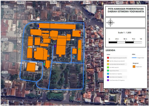
Map layouting is the final stage of map preparation that plays an essential role in presenting spatial information in a clear, systematic, and cartographically appropriate manner. Through the Layout Editor feature in the iT Sensing web application, users can organize map elements, adjust the layout, and customize the map scale and format. As a result, the final map becomes more informative, visually appealing, and ready for printing or publication.

Leave a Reply
Want to join the discussion?Feel free to contribute!